
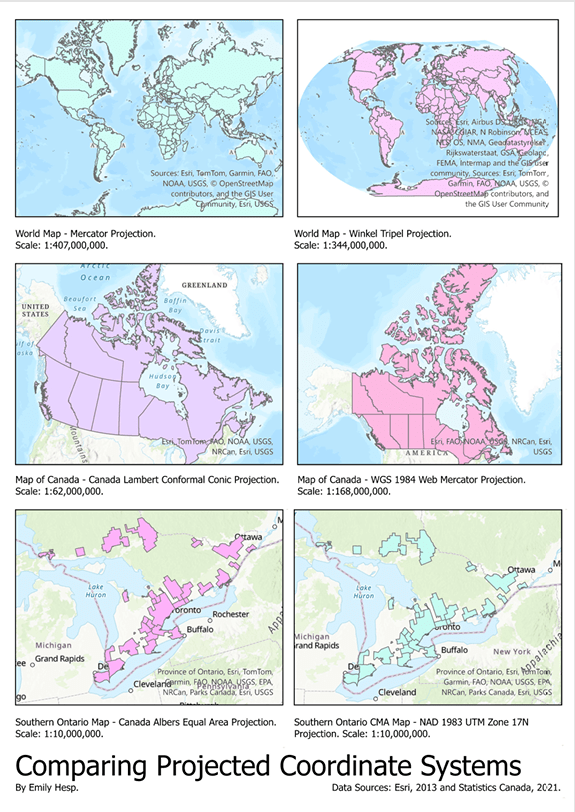
For this project, the following data was used to create six visualizations of six different map projections:
| Filename | File type | Description | Data reference (source) |
| worldcountriesWGS84 | Shapefile | Boundaries of countries mapped using the WGS84 coordinate reference system | Esri, 2013 |
| canada_prov_terrWGS84 | Shapefile | Boundaries of Canada provinces and territories mapped using the WGS84 coordinate reference system | Esri, 2013 |
| s_on_cmaWGS84 | Shapefile | Boundaries of census metropolitan areas of cities in southern Ontario, mapped using the WGS84 coordinate reference system | Statistics Canada, 2021 |
This was an assignment completed for class. We were expected to produce a map layout of three pairs of maps according to the following criteria:
- Project “worldcountriesWGS84” to:
- Mercator projection
- Winkel Tripel – (NGS – world)
- Project “canada_prov_terrWGS84” to:
- WGS 1984 Web Mercator (auxiliary sphere)
- Canada Lambert Conformal Conic
- Project “s_on_cmaWGS84” to:
- Canada Albers Equal Area
- NAD 1983 UTM Zone 17N
The final product submitted included a PDF of the map layout. We were also expected to provided responses to two questions that tested our knowledge and application of map projections. I included a PDF of my answers as well.

Leave a comment