
From the blog
-
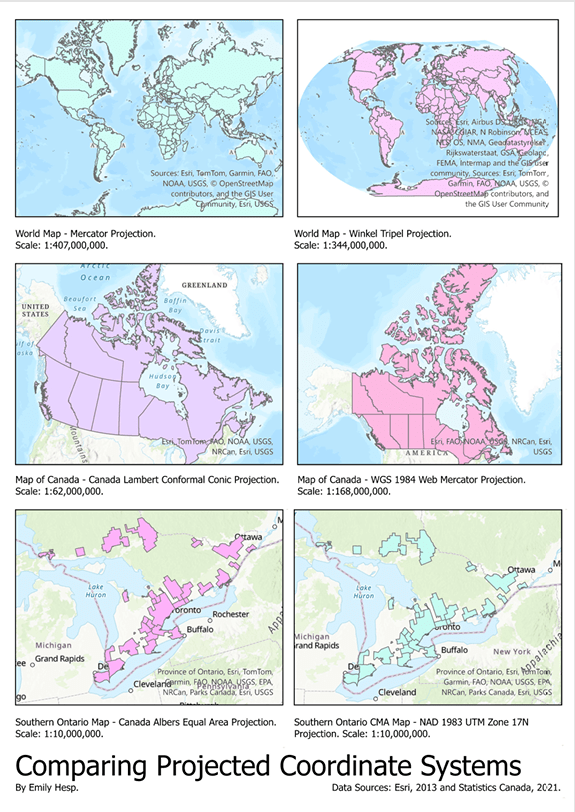
Visualizing Coordinate Reference Systems
For this project, the following data was used to create six visualizations of six different map projections: Filename File type Description Data reference (source) worldcountriesWGS84…
-

Basic Spatial Analysis Workflow: Identifying Optimal Locations for Childcare Centers
This is the first of many spatial analysis and visualization projects that I will share on this site. I am really happy that I chose…
-

Recent Sketches
Just three sketches for this post!
-

On Action & Happiness: A Short Essay
As Outlined by the Dalai Lama, Al Ghazzali and Aristotle. I wrote this essay for one of my classes in my first year of university…
Subscribe
