
Portfolio
-
Maps from Class Workshops
Here are two maps I created for two structured workshop assignments in my Advanced Geographic Information…
-
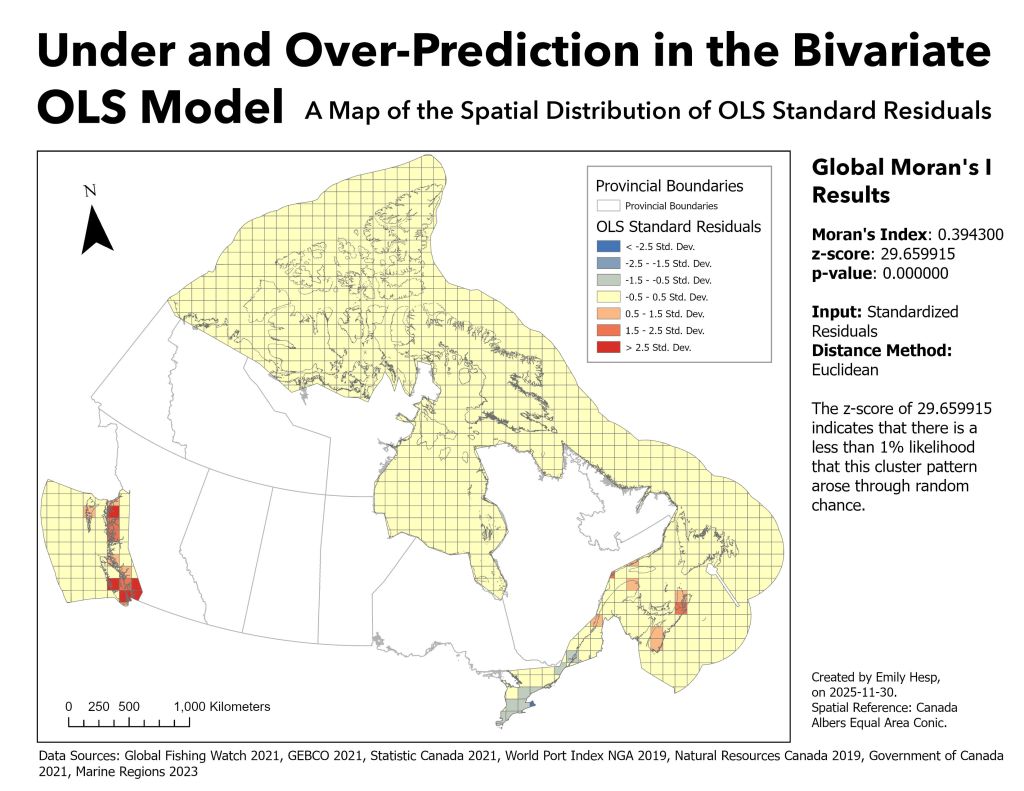
Maps from my Port Activity Research Project
Below are a few of the maps I created for a recent GIS research project examining…
-
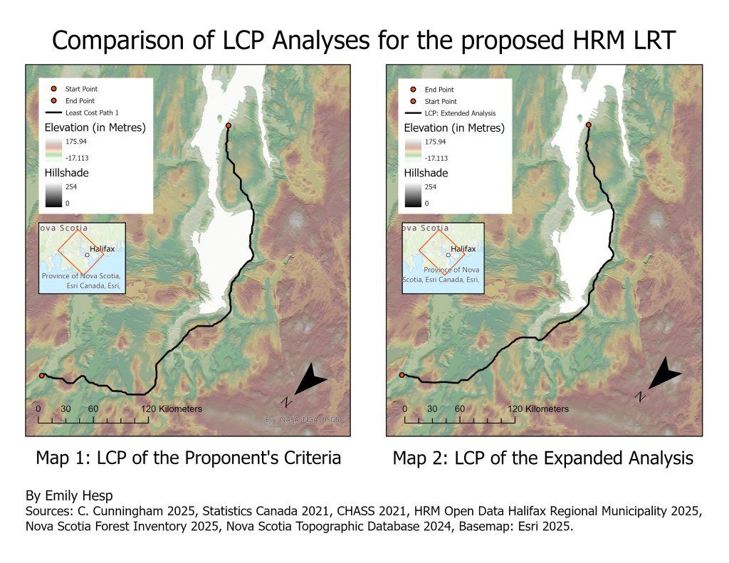
Geospatial Models from my Light Rail Transit Planning Project
This project was completed for one of the two Independent Projects assigned in my Geographic Information…
-
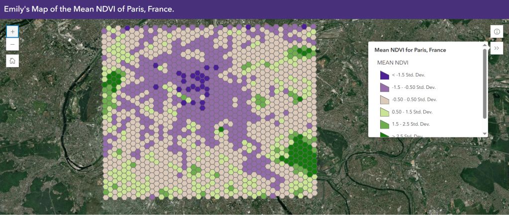
Mapping the Health of Urban Vegetation in Paris, France
Web Map Link: Click Here! This project was created for the unit on Remote Sensing in…
-
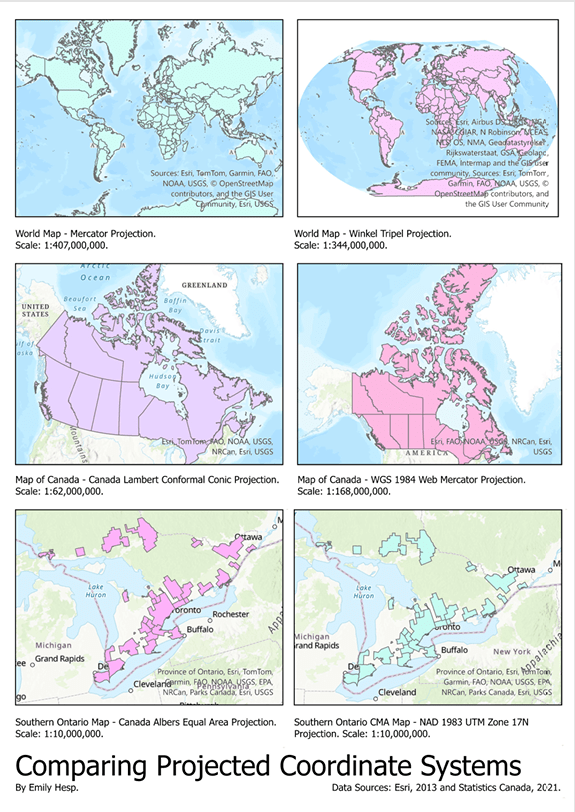
Visualizing Coordinate Reference Systems
For this project, the following data was used to create six visualizations of six different map…
-
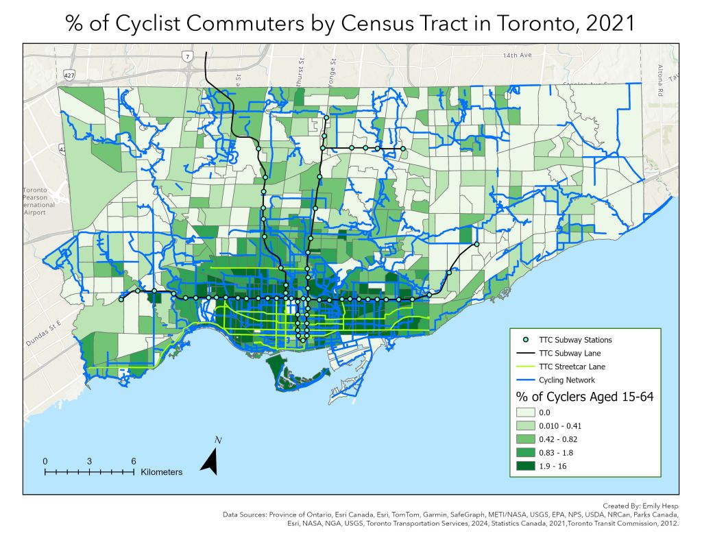
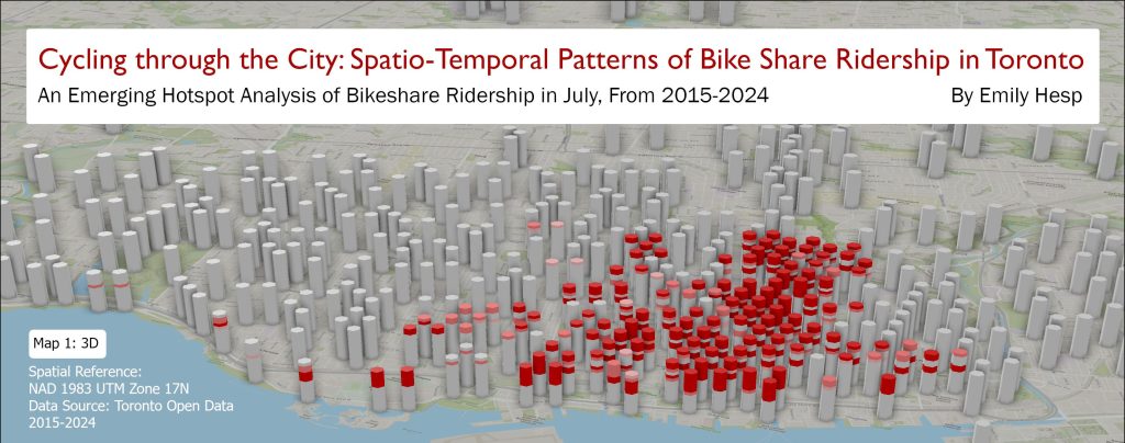
Where Cycling Infrastructure Matters Most: Mapping Commute Mode Data in Toronto
This map shows that high percentages of cyclists reside in the downtown core and are particularly…
-

Basic Spatial Analysis Workflow: Identifying Optimal Locations for Childcare Centers
This is the first of many spatial analysis and visualization projects that I will share on…
-
Selected Graphic Design Work (Canva)
This post features several graphic designs I created for a range of extracurricular activities, all of…
