
From the blog
-
The Strategic Use of Nationalism in War-Making:A Realist Analysis of State Behaviour in Russia’s War Against Ukraine
I completed this paper for a short essay assignment in my introduction to international relations class. Though short, I am quite content with the structure…
-
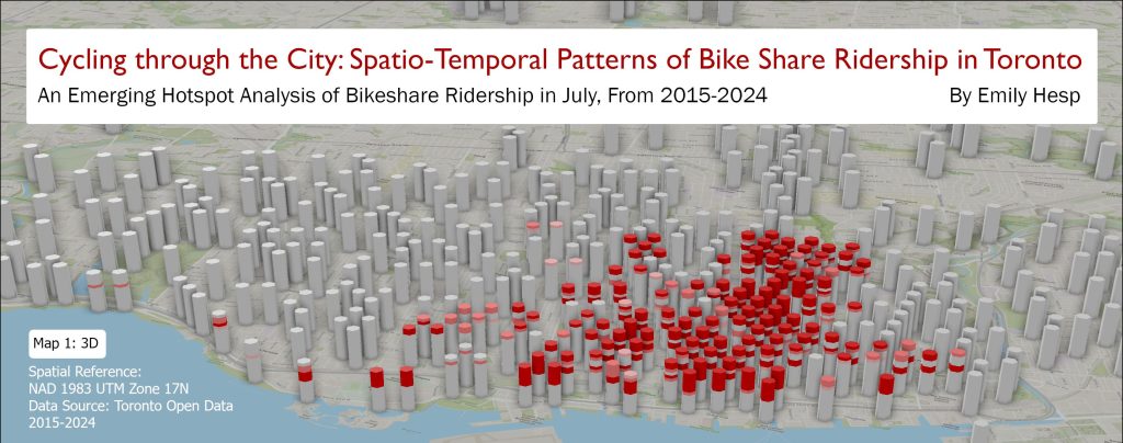
Maps from Class Workshops
Here are two maps I created for two structured workshop assignments in my Advanced Geographic Information Systems course. Feel free to comment or email me…
-
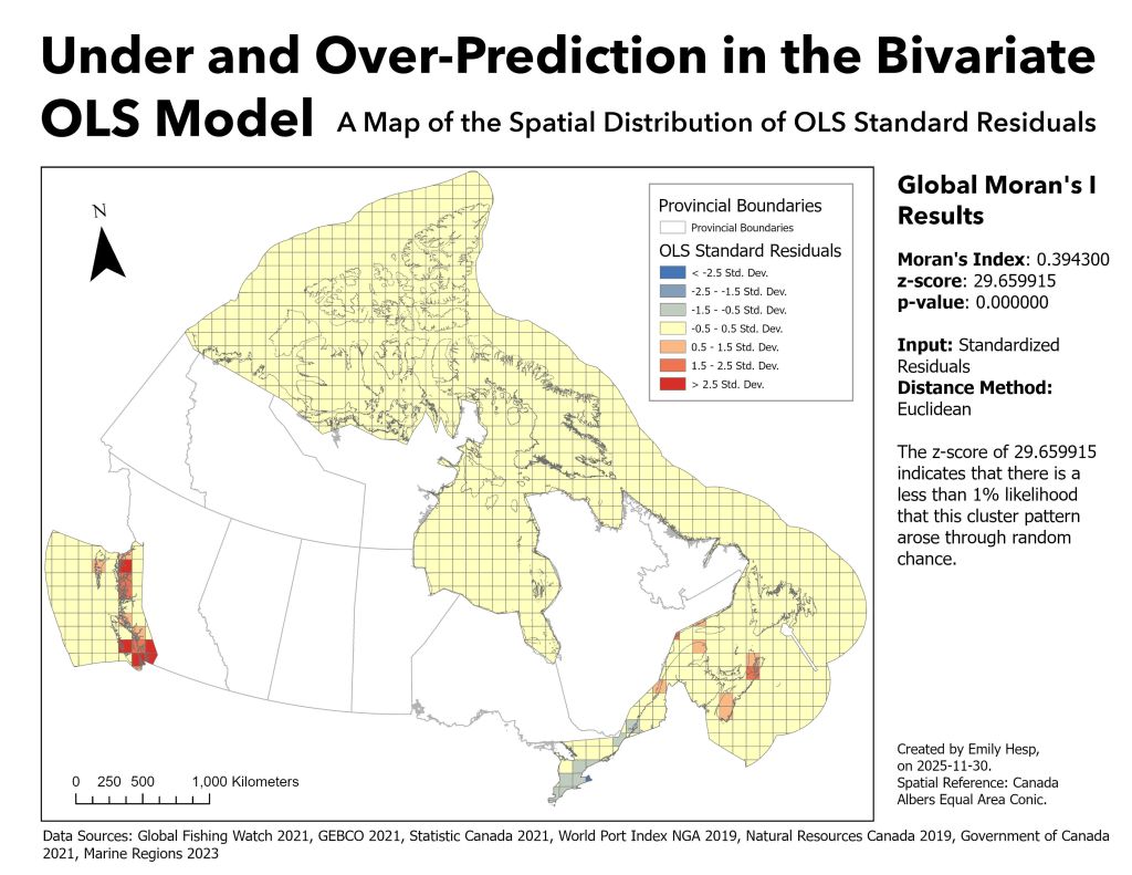
Maps from my Port Activity Research Project
Below are a few of the maps I created for a recent GIS research project examining port activity and recent port infrastructure renewal projects announced…
-
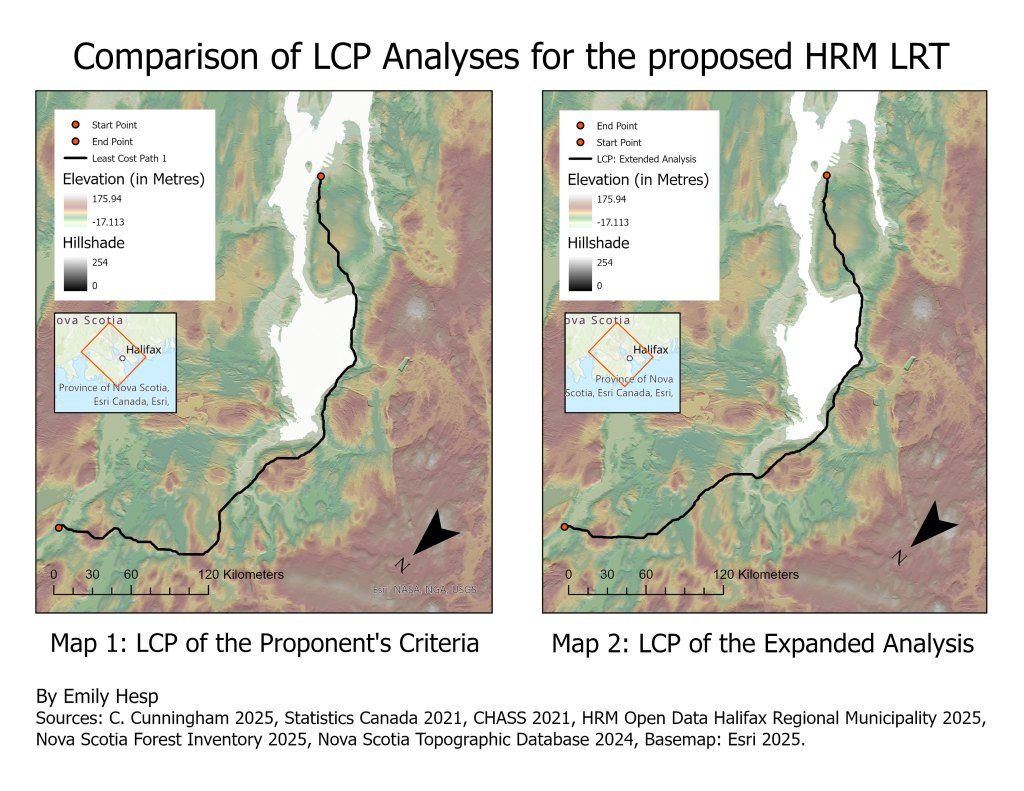
Geospatial Models from my Light Rail Transit Planning Project
This project was completed for one of the two Independent Projects assigned in my Geographic Information and Mapping II course last year. These projects had…
Subscribe
